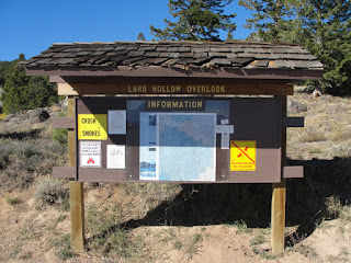
Larb Hollow Overlook on Scenic Byway 12
I generally don't write about an 'overlook' but I'll make an exception, today - from the official Scenic Byway 12 website:
"As Scenic Byway 12 descends the northern side of Boulder Mountain, this scenic overlook commands a stunning view of southeastern Utah, especially the Waterpocket Fold in Capitol Reef National Park and the Henry Mountains."
There are three interpretive signs facing this 'stunning view' that I want to share with you today.
First, the sign and view, followed by a close up of the sign - click on it [each of the photo images to see a larger view], and you should be able to read it...
The southernmost of the three sign looks directly out over the lake in the valley below - the Lower Bowins Reservoir, to be more precise. A favorite summer beach as well as fishing spot.
The middle sign looks right at the Henry Mountains to the east (most of the snow had melted by today).
The third sign was directed a bit north of east, featuring the Waterpocket Fold in Capital Reef National Park - this sign has especially interesting history of a woman's roll in mapping and recording this country in SE Utah and beyond.
A fascinating location! ;-)


No comments:
Post a Comment